
Lundeinjon
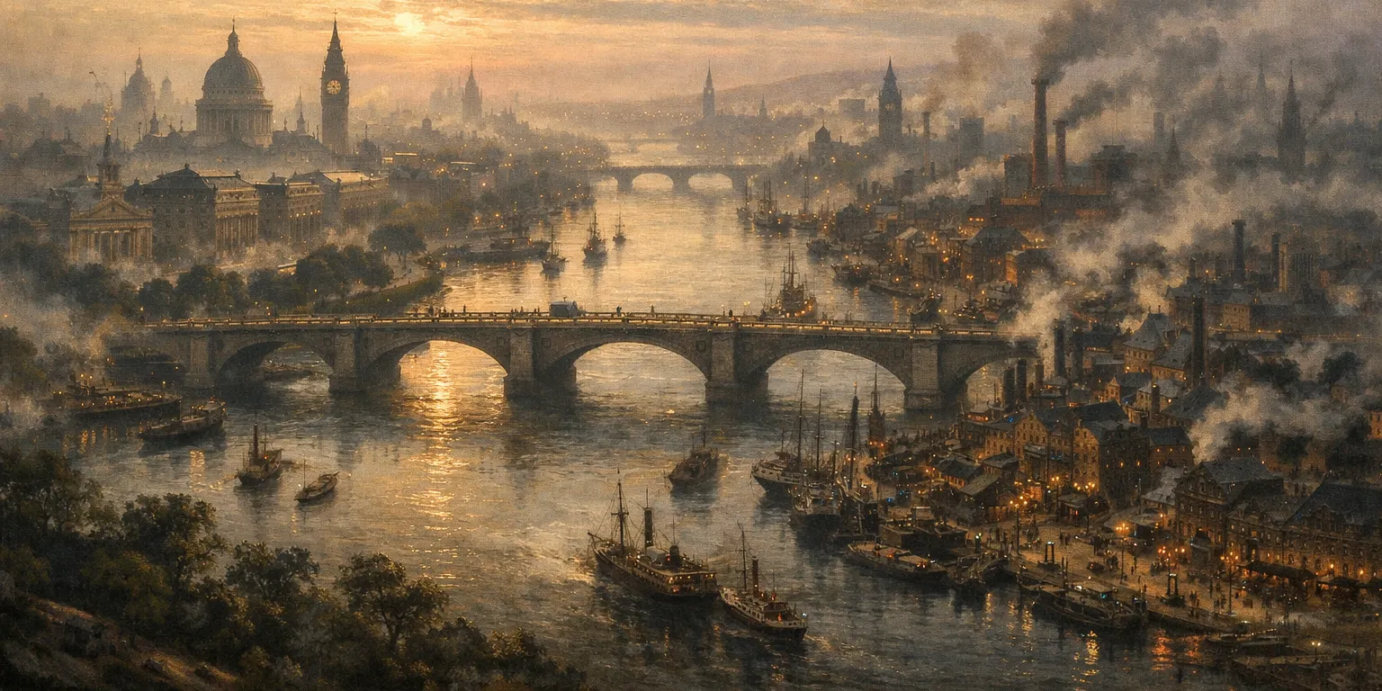
Lundeinjon is the capital of the Empire of Albion and the largest city in the world. It is located on the island of Albion, straddling the great River Lunde. The city covers 122 square miles and has an approximate population of 3.5 million people. It is the world's largest port and sits at the heart of international finance and trade.
The Albion Railway connects Lundeinjon to the rest of the island, while its docks and shipping lanes link it to the wider world. The Wayfarer's Guild also provides magical transportation throughout the bounds of the Empire, although the Rites of Sovereignty prevent such travel across national boundaries. Those wishing to be magically transported beyond the Empire may instead take one of the regular ferries to the Independent Principality of Piffling, which lies just south of the island of Albion and is the busiest of all the Wayfarer states due to this proximity.
Districts
There are many ways in which the city of Lundeinjon can be subdivided. The first and most obvious divide is between its eastern and western halves. These are separated by the River Lunde and can be seen as almost two different cities, linked by several bridges. The eastern side of the city is larger, denser, and poorer, characterized by narrow, crooked streets, crowded tenements, and heavy industry. The western side contains the old city, the center of financial and political power, marked by broad avenues, monumental architecture, and an abundance of parks and museums.
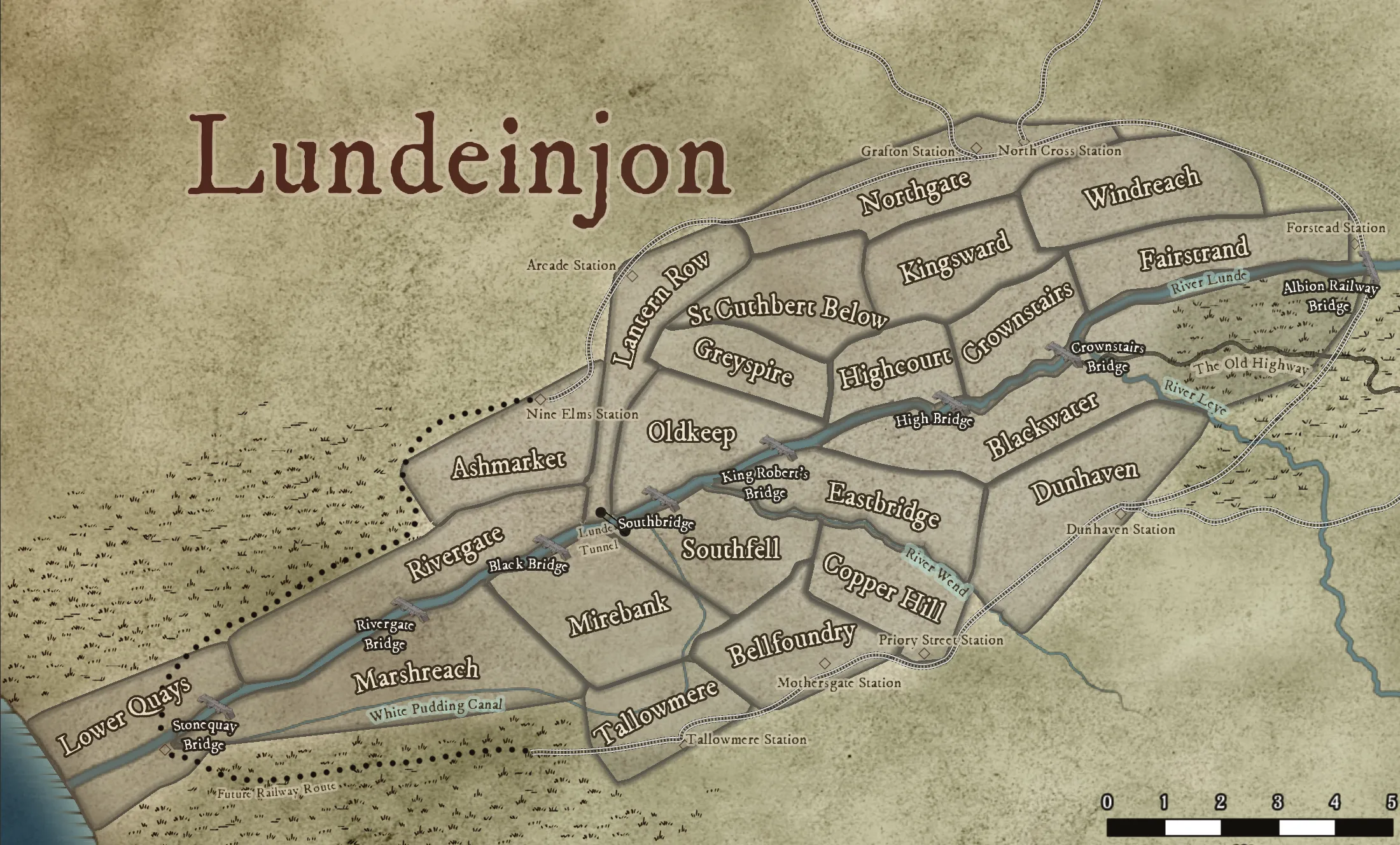
Within this broad division lie the individual neighborhoods, each with its own character. Most people agree that there are at least twenty, though the exact list varies from one Lundeinjoner to another. One commonly used division is the map produced by the Lundeinjon Metropolitan Police Force, which identifies twenty-two distinct regions for the purposes of policing the city.
- Ashmarket: Lundeinjon's premier mercantile hub and a bustling middle-class district, defined by a dense sprawl of covered markets, global wholesale exchanges, and prestigious corporate headquarters where every level of Society comes to trade.
- Bellfoundry: A cramped industrial quarter dominated by foundries, forges, and metalworks, famous for its bells, clockworks, and the constant thunder of hammer on iron.
- Blackwater: A low-lying, often flooded area that is being rapidly developed into cramped housing and workshops.
- Copper Hill: A narrow maze of workshops and tenements known for fine metalcraft, penny factories, and the dense working-class population that supports them.
- Crownstairs: A grand riverside district of stepped embankments, elite residences, and ceremonial landings used by officials of the Crown and visiting dignitaries.
- Dunhaven: A quiet, fog-bound quarter of modest residential streets, chapels, and beer shops. Many residents commute into the inner city.
- Eastbridge: An ancient and overcrowded warren on the eastern bank notorious for its sprawling slums, diverse immigrant population, and a dangerous history of crime and hidden cult activity.
- Fairstrand: A comparatively pleasant riverside district of promenades, public gardens, and middle-class housing, popular with clerks, shopkeepers, and families.
- Greyspire: The administrative and investigative heart of the city, dominated by imposing civic buildings and serving as the headquarters of the Police.
- Highcourt: Serving as the legal and bureaucratic heart of the city, this district is defined by broad avenues, monumental imperial architecture, and the high Gothic spires of the coronation cathedral.
- Kingsward: The prestigious and heavily guarded home of the Imperial Family and Society elite, defined by vast verdant parks, aristocratic estates, and exclusive luxury shopping thoroughfares.
- Lantern Row: A brightly lit and storied district centered on "the March," famous for its theater-lined streets, alchemical gas lamps, and a vibrant nightlife frequented by artists and students alike.
- Lower Quays: Centered on the mouth of the river, this bustling port district is a gritty landscape of enclosed docklands, shipyards, and transient sailor housing dominated by the constant churn of maritime trade.
- Marshreach: A damp outer district built on reclaimed wetlands, prone to flooding and subsidence, and home to the city's poorest laborers and scavengers.
- Mirebank: A bleak riverside neighborhood of silted wharves and leaning tenements, long associated with smuggling and illicit river traffic.
- Northgate: A rapidly expanding and modern hub defined by the progress of The Albion Railway, housing the city's major stations, grand museums, and a diverse population of newcomers from across the Empire.
- Oldkeep: The ancient core of Lundeinjon, enclosed by remnants of the original City Wall and packed with winding streets, ruins, and venerable institutions like the Bank of Albion and The Imperial Mint.
- Rivergate: A strategic district controlling river traffic, bridges, and customs houses, and home to the River Patrol of the Metropolitan Police Force.
- Southfell: A rough southern quarter of slaughterhouses, stockyards, and worker housing, infamous for violence and hard living.
- St Cuthbert Below: A densely populated parish district clustered around the lower precincts of St Cuthbert's, shaped by charity, poverty, and quiet devotion.
- Tallowmere: A foul-smelling industrial neighborhood centered on rendering yards and candle works, where animal fats are processed for the entire city.
- Windreach: A high and drafty district once settled by refugee magicians, now home to artists, clerks, and political reformers.
Other Neighborhoods
While the list above describes the LMPF districts, the people of Lundeinjon will frequently refer to other neighborhoods that do not accord to this map. Here are some of the names a visitor might encounter:
- Almsward: A neighborhood straddling the border of Mirebank and Marshreach, primarily known for its trio of charitable hospitals.
- Crocus Hill: The upper part of St Cuthbert Below, near to Highcourt and adjacent to Monksfield.
- Frog Island: A slum neighborhood located in the Southfell district.
- Kenningham: A crossroads neighborhood straddling the border of Blackwater and Dunhaven, home to a well-known cricket green.
- Maidenwolfe: An area that spans the intersection of Northgate, Kingsward, and Windreach, known for its universities and museums.
- Monksfield: Located on the border of Highcourt and St Cuthbert Below, this is a slum neighborhood in the shadow of St. Cuthbert-on-High. Also known as "The Serpent's Acre".
- The Nick: A notoriously damp and crime-ridden quarter of narrow alleys straddling the border between Eastbridge and Blackwater.
- Nightwater: A neighborhood in western Blackwater with a distinctly maritime character, centered around the old palace that now houses retired sailors.
- Old Ashes: A neighborhood within Rivergate marking the historical site of the city's original marketplace and its nine ash trees.
- Vesper Court: A refined area at the end of the March known for its elegant riverside townhouses and discreet private clubs.
History
Lundeinjon was founded in 17 ID by conquerors from the Pallaman Empire of Elbid. It was initially a simple trading post upon the River Lunde, selected because it provided a favorable location for the Pallamans to construct a bridge across the river. The settlement slowly gained prominence over the next two centuries, becoming the seat of the Pallaman governor of Albion in 269 ID. At this time, the City Wall was constructed, enclosing the area known today as Oldkeep. Portions of this wall remain standing to this day, although it is no longer a functional defensive structure.
During the fourth century, a second, larger wall was constructed to defend against pirates and raiders from Elbid who were plaguing the coast of Albion. This wall surrounded several of the neighborhoods on the western bank of the Lunde, including Highcourt, Greyspire, and St Cuthbert Below. To many, these regions remain the true city of Lundeinjon, with all later expansion seen merely as extensions rather than part of its historic heart.
However, Pallaman rule in Albion was coming to an end even as this second wall was being built. Lundeinjon soon fell under the control of the very raiders it had been designed to resist, as they carved the western half of Albion into dozens of petty kingdoms and principalities. During this period, the city remained an important strategic and commercial hub, dominating the southern stretch of the Lunde. Its population declined sharply, falling from a height of approximately sixty thousand to barely ten thousand, and remained between ten and twenty thousand until the late tenth century. Growth resumed when Lundeinjon became part of the Kingdom of High Albion, accelerating dramatically after the Arvoringian invasion in the mid-eleventh century. In 1082, Lundeinjon was named the capital of High Albion under King Robert I.
Under the Arvoringian kings, Lundeinjon underwent a massive transformation as the conquerors fortified their new capital against Albion's native population. In 1107, a catastrophic storm devastated the city's wooden structures, including the destruction of the old wooden bridge across the Lunde. In its aftermath, the bridge and many other buildings were rebuilt in stone, and many of these structures remain part of Lundeinjon's cityscape today. The city prospered financially under Arvoringian rule and expanded rapidly, reaching a reported population of eighty thousand by 1316.
This prosperity was abruptly halted by the Andian Plague, which spread from Elbid to Albion and ravaged the city between 1316 and 1320, claiming the lives of forty thousand inhabitants. Despite this devastation, Lundeinjon endured, and its population recovered to pre-plague levels by 1350, bolstered by immigration from rural Albion and from abroad.
During the late fourteenth and fifteenth centuries, Lundeinjon became increasingly important as a trading hub. The Kingdom of High Albion expanded to encompass two-thirds of the island, with only the Kingdom of Alba remaining as a rival. Albion ships traveled across the known world, and Lundeinjon emerged as one of the wealthiest cities in Elbid. In 1510, King Edmund VII broke with The Church and founded the Church of Albion, initiating another major period of transformation for both the city and the kingdom. The new church's acceptance of Magic prompted a wave of migration, as magicians from Elbid sought refuge in the one realm where they could practice openly, though not without prejudice and persecution.
The neighborhood of Windreach became known as a haven for these refugee magicians, and aftereffects of their magical experimentation are said to linger there to this day. The thaumaturgical Little Alligator's Club remains located in the district. Although the center of thaumaturgical scholarship has since shifted to the University of Carbury, the roots of Albion thaumaturgy remain firmly planted in Lundeinjon.
As Magic came to permeate the Kingdom of High Albion and its capital, the city began to assume its modern form. By 1553, the population had grown to one hundred thousand, coinciding with the unification of High Albion and Alba into a single Empire. Over the next fifty years, the population doubled once more to two hundred thousand. Villages that had once lain half a day's walk from the city were absorbed into Lundeinjon, while neighborhoods on the eastern bank of the Lunde expanded rapidly, cementing the wealth and class divide between east and west that persists to this day.
Over the following two centuries, the city's growth never truly slowed, rebounding with astonishing speed from losses caused by war, fire, and plague. In the years following the Dragon Wars, Lundeinjon became firmly established as the largest and most influential city in the world, the center of Imperial power, and the hub around which history itself now turns.
Maps
-
Lundeinjon
East is South, North is West
Newcomers to Lundeinjon, or those perusing a map, are often confused by the division of the city into east and west, when north and south might seem more appropriate. The River Lunde, for most of its course, runs from north to south, and thus has an east and west bank. A few miles upstream of the city, however, the river bends westward on its way to the sea and passes from northeast to southwest through the city, yet the banks are still called east and west, not north and south. This is a tradition inherited from the pre-Pallaman residents of Albion, whose names for the shores were based on the flow, not the cardinal directions - when their place names were translated into Pallaman, they became East & West - regardless of what the river was currently doing.
Thus, when the city was first built, it was said to stand on the west bank of the Lunde. As it later expanded across the river to the south, those new neighborhoods were nevertheless described as lying on the east bank. While this convention can confuse those unfamiliar with it, it has been established for so long that there seems little hope of changing it. It is common in Lundeinjon to speak of going south to the east bank, or north to the west bank, and it is understood that these are labels - not expressions of geographical truth.
Getting Around Lundeinjon
Lundeinjon has hundreds of miles of roads, and almost all of them are crowded. Getting from one place to another can be a time consuming process, but there are some methods that are faster than others.
The most commonly used methods are walking (free), and getting a cab (price varies). If you own or can hire a carriage, that’s an excellent and comfortable way to get around. Also, there are hundreds of independent omnibuses, drawn by construct horses and following prescribed routes. Watermen for hire are all along the riverfront, ferrying passengers up and downstream in their wherries, while The Albion Railway offers another path, with lines that run around much of the city perimeter. But for the wealthy, there’s an even faster way: Magic.
The Wayfarer's Guild maintains several waystations around the City, where a Guild Thaumaturge will be available to transport paying customers instantly to their destination. For transport from one in-city waystation to another, this costs 1 Crown per passenger (about a week’s wages for a skilled worker). Transport to a non-standard location may be available at higher costs, but only if a thaumaturge is available who is familiar with the destination; blind teleports are not safe.
Not every district has a Guild Waystation; they only maintain them in locations likely to have paying customers. Here is a list of where they are located:
Crossing the Lunde
There are many places where one can cross the Lunde, by bridge, tunnel, or ferry. Here is a list:








That is an interesting way to come up with districts, normally such divisions are tied to political fields like seats on a city council or the like. Tying it instead to the police force, and therefore, presumably some amount of authority for various precincts and the like, is an interesting approach, I like that.
Thanks! In this city, the police map was the first legal breakdown of the neighborhoods, and it's pretty controversial - lots of people think it doesn't map cleanly against the way people actually treat the city, but it was a good balance for the needs of the LMPF.