TERMINUS VIAE ORIENTALIS
The Road’s End · Road Terminus · Provincia Orientalis
"The Via Orientalis ends here. That is the correct way to say it: it ends. Not at a gate, not at a city wall, not at a port where the sea continues what the road began. The road ends in the open air, at a set of carved limestone markers, and beyond those markers there is a forest that the road does not enter. The provincial road authority maintains the markers. The road authority’s annual inspection reports note, every year since 1167, that the markers’ positions have changed from the previous year’s survey. The Senate acknowledges receipt. I find this the most honest available summary of the Empire’s current relationship with Sylvanmere."
The Terminus Viae Orientalis is the formal end of the Empire’s eastern road network: the point three kilometres east of Porta Silvae’s eastern gate where the Via Orientalis’s maintained surface concludes at the boundary stone line. The road authority’s terminal marker — a carved granite pillar at the road’s exact end, bearing the standard Roman road insignia, the road’s length from Nova Romae, and the date of the last official maintenance survey — has been replaced twice in the city’s history: once because the original stone cracked, and once because the replacement stone was found to be in a position the survey record did not indicate it had been placed in. The current pillar’s survey date is twelve years old, which means it either predates or postdates the period in which the boundary stones began recording positional changes in the annual inspection reports. The road authority knows which. They have not published the distinction.
The terminus is not architecturally significant and is among the most significant places in the Empire. It is the eastern limit of the Roman road network, the formal boundary of the infrastructure that connects the Empire’s cities, and the point at which the institutional certainty that roads provide — the certainty of having been there, of having surveyed and paved and maintained — runs out.
Purpose / Function
The road terminus’s formal function is administrative: the end point of the road authority’s maintenance jurisdiction, the location of the annual survey measurements, and the anchor point for the boundary stone line that marks the Empire’s formal eastern limit. Its de facto function, for the population of Porta Silvae and the visitors who undertake the Boundary Walk, is entirely different: it is the closest point of maintained Roman infrastructure to the treeline, and standing at it is the experience that most closely approximates what it would mean to stand at the forest’s edge within the framework of Roman civic life. The garrison’s boundary stone protocols make crossing past the terminus into the transition zone an official act requiring authorisation. The terminus itself requires nothing.
Design
The Via Orientalis’s packed gravel surface, maintained from the eastern gate, ends cleanly at the terminal marker’s position. The terminal marker stands at the road’s centreline. The twelve boundary stones extend north and south from this point, each approximately ten metres apart, forming a line that the road authority’s surveys treat as the Empire’s eastern boundary and that the forest has been treating differently for at least thirty-three years of documented positional change. The transition zone begins immediately east of the boundary stone line: the botanical density that the Academy’s surveys document as containing species found nowhere else in Aethermarch, growing in patterns that are directed but not by any hand the surveys have identified.
Entries
The Boundary Walk path leads directly to the terminal marker; no restriction on approach to this point. Movement past the boundary stone line into the transition zone requires authorisation from the Governor’s office under the current garrison protocols, enforced with the pragmatic flexibility that a small garrison applies to a path used by thousands daily. The garrison’s two permanent observation positions along the walk are both staffed; the boundary stone line itself is patrolled at intervals. In practice: stopping at the boundary stones is unimpeded; stepping past them draws a polite request to return; declining draws a less polite one.
Sensory & Appearance
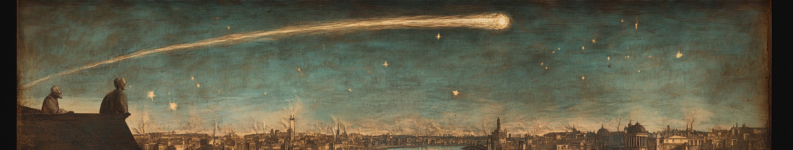
Approaching along the Boundary Walk in the late afternoon: the path narrows psychologically before it narrows physically, the transition zone’s botanical density pressing in on both sides in the final kilometre. At the terminal marker: the smell of the transition zone’s plant life is distinct from the farmland behind — denser, slightly warmer, with a note the Academy’s botanists describe as ‘characteristic of high-humidity canopy environments’ and that does not match any humidity measurement taken in the open air at this location. The evening light at the boundary stones is the anomalous light that the Watching Painters have been attempting to render for five centuries: warmer than the atmospheric conditions explain, sustained longer into the evening than the sun’s angle permits, and doing something at the boundary between human attention and the forest’s that is the subject of the city’s entire cultural life. The transition zone beyond the stones is quiet in a way that differs from the absence of noise. Something in it is attending.
Denizens
The road authority’s inspection team, present for approximately two weeks each autumn for the annual survey. Between inspections: the garrison’s patrol soldiers, the regular walkers whose schedules bring them to the boundary stones consistently, and the variable population of pilgrims, scholars, and artists who come to the terminus for the light. The regular walkers’ collective knowledge of the boundary stones’ daily and seasonal variations is more detailed than any official record. They have not been formally asked to share it.
Valuables
The road authority’s accumulated thirty-three years of positional change records, filed in the Porta Silvae office, are the most complete documentary evidence of the boundary stones’ movement available anywhere. They have not been published. They have not been destroyed. They are in a filing cabinet in an office whose staff have access to them and have been filing them annually without comment for three decades. A party with legitimate access to public provincial records could request the annual inspection reports through the provincial archive’s formal document access procedure. The road authority has not restricted this access. Nobody has requested it.
Special Properties
The light anomaly is at its most concentrated at the boundary stones in the late afternoon. The Academy’s instruments cannot measure what the eyes experience here, which is not the instruments’ failure but a feature of what the anomaly is: it requires the specific interaction of living attention with the forest’s proximity that instruments, whose attention is not living, do not produce. Standing at the terminal marker at the correct hour, in still conditions, with the forest visible across two hundred metres of the transition zone’s botanical density, is the experience that the shrine’s liturgy, the artists’ canvases, and the Academy’s measurements are all attempting to mediate. The terminal marker removes the mediation. Some visitors find this more than they were prepared for.
Alterations
The terminal marker has been replaced twice. The boundary stone line’s positions have changed annually since at least 1167. The transition zone’s botanical boundary has moved approximately twenty metres westward since the Academy’s earliest surveys. The road authority’s socket relocation in 1179 — categorised as routine maintenance — moved the terminal marker to accommodate a boundary stone line that was no longer where the original socket had been placed. This sequence of alterations documents, in the road authority’s own records, that the Empire’s eastern boundary has moved westward in the period of systematic observation. No official has been required to state this directly.
Architecture
The Boundary Walk’s paved first kilometre gives way to the packed gravel surface that extends to the terminus, both maintained by the provincial road authority to the standard that a path used by thousands of visitors annually requires. The terminal marker’s granite is darker than the limestone boundary stones — a functional distinction that makes the road’s formal end visually identifiable from a distance. The transition zone’s botanical density immediately beyond the boundary stone line provides the most dramatic natural architecture in the province: plant life organised in the direction of the forest, its density and species composition unlike anything elsewhere in the province.
History
The road reached its current terminus in the city’s founding generation, the Via Orientalis’s eastward extension ending at the point where the founders determined the forest began in some meaningful sense. The boundary stones were placed at their original positions in the city’s first century. They were moved forty metres west by an unspecified means three days after placement — the founding generation’s account of this event is in the provincial archive and has been read by every Governor since — and have not been deliberately moved since. The annual inspection reports’ positional change records began in 1167. For full chronological detail, see: Annales Mundi.
Tourism
The terminus is the Boundary Walk’s formal destination and the point at which the six-kilometre return walk’s significance is most concentrated. The sunset walk’s recommended timing brings visitors to the boundary stones at the anomalous light’s peak, which is the experience the city’s entire infrastructure has been organised to make accessible. First-time visitors who are expecting a dramatic landscape feature sometimes find the terminus understated: twelve modest limestone markers, a granite road pillar, a path that ends. The forest two hundred metres away, doing something to the light that no instrument has adequately measured. The veterans of the walk stand here and do not speak.
Light anomaly at maximum intensity at the boundary stone line in late afternoon. The Academy’s instruments cannot measure the anomaly’s specific quality. Something in the transition zone is attending.
Access
Path and terminal marker: fully public.
Transition zone beyond boundary stones: Governor’s office authorisation required; enforced by garrison patrol.

Comments