


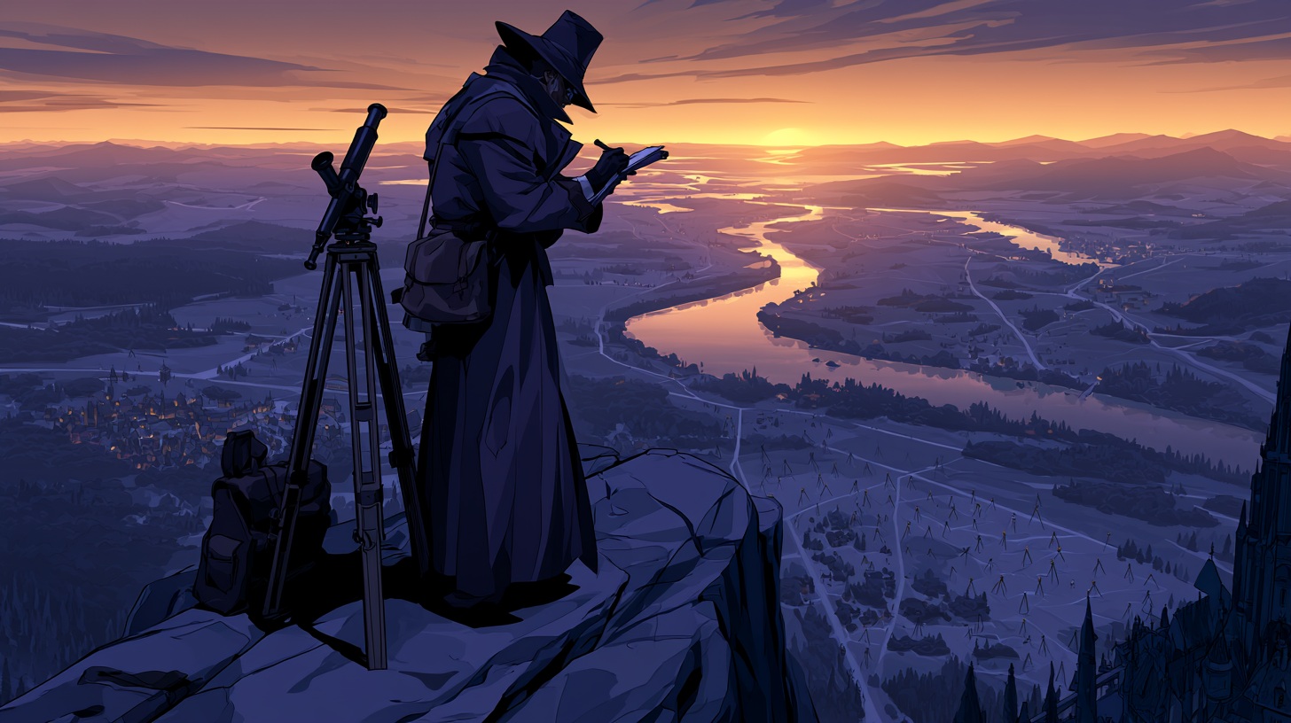
Surveyor
Degrees of Interest
“The duke claimed the river marked his border. The count claimed the same river marked his. After three months of arguments, I discovered the river had moved and neither man had noticed.”
Most people think maps describe the world.
Surveyors know the opposite is often true.
Maps do not merely record reality. They shape it. Borders appear because someone drew them. Roads are built because someone measured a route. Property exists because someone determined where it begins and ends. Taxes are collected because someone decided how much land belonged to whom. Entire wars have begun because two maps disagreed.
The Surveyor lives at the point where geography and power intersect.
Their profession is built upon a deceptively simple task. Measure the land accurately. In practice, this responsibility extends far beyond distances and landmarks. A Surveyor determines where kingdoms meet, where noble estates begin, where roads should be built, where settlements may expand, and where valuable resources can be found. They provide information upon which merchants, governments, armies, landowners, and explorers all depend.
The work demands precision.
Nature rarely cooperates.
Rivers change course. Forests expand and retreat. Floods erase landmarks. Roads fall into disrepair. Entire villages vanish between one survey and the next. The Surveyor learns quickly that the landscape is not a static thing. It shifts constantly beneath the assumptions of those who believe ownership can be settled permanently.
This creates an unusual perspective on the world. Most people view land through personal experience. A farmer sees fields. A merchant sees routes. A soldier sees terrain. A Surveyor sees relationships. Hills affect drainage. Rivers influence trade. Forests create boundaries. Roads shape economies. A single bridge may determine the prosperity of an entire region. Every feature exists as part of a larger system.
Years spent studying these connections leave lasting habits.
Surveyors develop an instinctive awareness of distance, direction, and terrain. Many find themselves estimating dimensions without conscious effort. Others become fascinated by infrastructure, noticing roads, walls, canals, and bridges the way artists notice color or musicians notice rhythm. They spend so much time translating landscapes into measurements that they begin seeing patterns invisible to most people.
The profession often attracts practical minds. A survey cannot be negotiated into accuracy. A hill remains where it is regardless of political preference. A river does not alter its course because a noble dislikes the result. For this reason, Surveyors tend to place considerable faith in observation and evidence. They spend their careers measuring reality as it exists rather than as others wish it existed.
Unfortunately, reality is frequently inconvenient.
Many Surveyors discover that accurate information can be politically dangerous. A survey may reveal that a wealthy estate occupies land it does not legally own. A new map may place valuable resources within disputed territory. A border established generations earlier may prove inaccurate. Such discoveries rarely make powerful people happy. History contains many examples of maps being altered, hidden, ignored, or rewritten to serve interests more influential than accuracy.
This is why experienced Surveyors often develop a healthy respect for the political consequences of their work.
A map is not merely a tool.
It is evidence.
A detailed survey can influence trade agreements, military campaigns, inheritance disputes, tax policies, construction projects, and diplomatic negotiations. Entire fortunes may depend upon a line drawn across parchment. Entire communities may find themselves governed by different authorities because of measurements recorded by a person carrying a notebook and a set of instruments.
Despite these responsibilities, the profession also appeals to those who love exploration. Every unexplored valley, unmapped coastline, forgotten road, and distant frontier presents an opportunity. Surveyors are often among the first people to document regions previously known only through rumor. They travel extensively, endure difficult conditions, and spend long periods working far from civilization. The work combines scholarship, navigation, and adventure in equal measure.
Many become deeply attached to the landscapes they study. A mountain range surveyed over several years becomes familiar in a way outsiders rarely understand. Rivers acquire personalities. Valleys become old acquaintances. Certain roads, landmarks, and campsites become woven into memory through repetition and experience. The Surveyor may measure land professionally, but familiarity often grows into affection.
The profession also fosters a certain skepticism. Surveyors learn that maps are only as trustworthy as the people who created them. Every chart contains assumptions, omissions, and limitations. Every record reflects choices made by its creator. As a result, experienced Surveyors rarely accept information without verification. They have spent too much time correcting mistakes left by confident people who measured poorly.
A Surveyor's pack usually contains notebooks crowded with observations, calculations, corrections, and annotations. Most appear meaningless to outsiders. To the Surveyor, they represent something far more important.
Proof.
Proof of where the road actually runs.
Proof of where the border truly lies.
Proof of what is really there once politics, rumors, ambitions, and assumptions are stripped away.
The world may belong to kings, merchants, armies, and nobles.
Someone still has to measure it.

“People think I draw maps. What I actually do is travel into the wilderness, discover where reality is located, and then return to explain the matter to people who were certain they already knew.”
Type
Private Services


Comments